
A wrench in the works.
Hilgard Peak (11,316 ft.), located in a remote part of the Lee Metcalf Wilderness near the northwest corner of Yellowstone Park, is the highest peak in Montana outside of the Beartooths. My friend Spencer and I wanted to hike in from the east via the Beaver Creek Trail, camp near Avalanche Lake, and then bush-whack over to climb it the next day. However, when rangers at the Earthquake Lake Visitor Center told us the road to our trailhead was closed due to a fire we decided to hike in from the Papoose Creek Trailhead west of Hilgard – a much less popular approach. If I’d known how difficult it was going to be, I would have backed out. The 18-mile trek, which included 6,000 feet of elevation gain (much of it off-trail), ranks as one of the most grueling adventures I’ve ever done – but it was a GREAT experience!
Second thoughts.
Our journey started at the Papoose Creek Trailhead 34 miles south of Ennis at 1:45 pm Tuesday (9/2/25)). After following the trail for 6.5 miles, we veered off and up a steep forested slope to the place where we set up camp. Despite the steady uphill I was doing okay on the trail, but the last half mile up the steep slope with a 30-pound pack about killed me! We set up our tents, explored the neighborhood, ate, and filtered water from the nearby creek. As I laid in my tent that night I contemplated how I was going to tell my young friend that at some point along the way he would have to continue onto the peak by himself while I waited – I was that exhausted!
Mojo.
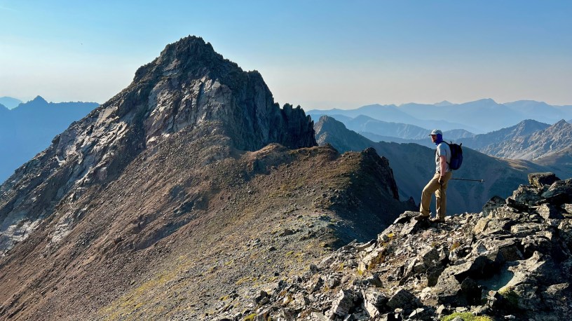
Wednesday morning came, and by 7 am we were on our way. We left our tents and gear (to be picked up on the way back), so our packs were light. It was a beautiful morning and my legs didn’t feel awful, so I was thinking I could probably make the steep 1-mile hike to the ridge before tapping out. As we approached the ridge I became increasingly optimistic that I might actually be able to climb Hilgard. Then upon reaching the ridge top, the combination of seeing how close we were and witnessing the beauty of the basin below, along with Spencer’s contagious determination – all gave me the energy and confidence that I could reach the summit.
Two for one.
Our walk down the other side of the ridge and across the boulder-filled basin to the foot of Hilgard was filled with anticipation. We knew there was some sketchy climbing awaiting us, but if others could do it so could we. We found the gully that we’d read about in trip reports and carefully ascended it, doing some segments one at a time to avoid having the lead climber causing rocks to tumble down on the follower. There were a couple moves that were out of our comfort zone, but we made it! Our reward was half an hour of perfect summit time with some of the best views in the state (see link to photo tour below). After we carefully climbed down I was able to cross a second adventure off my bucket list as well – swimming in a lake over 10,000 feet, albeit a short, very cold swim! (see video in photo tour)
Home stretch.
At 12:30 pm we started walking back to our campsite, and by 2:30 pm we had the tents taken down and everything packed up. The final 7 miles from the campsite to the trailhead, which was a real slog, took slightly less than 3 hours. By 7 pm we were seated in the Bridger Brewing near Three Forks, awaiting our burgers. No beer this time though. As tired as I was, I feared that a single beer might put me in a coma.
FYI
Although it doesn’t feature extreme climbs like Hilgard, 100 Classic Hikes: Montana by Douglas Lorain is one of the best resources around for finding hikes and backpacking trips all over Montana.
- Photo tour of our Hilgard Peak Adventure
South of Ennis. - Adam Helman’s Trip Report
The most helpful information I could find.
Below: This map marks hikes that have been featured on bigskywalker.com so far, including several in Glacier Park – Select full screen to expand, zoom in for more detail, or click on a marker for a link to the post.

Really great post! And this ridge looks really impressive!
Thank you for sharing and greetings from Greece!
LikeLike
Great post! We are heading out that way this weekend and were also surprised by the Beaver Creek news. This has been super helpful, thank you for sharing!
Nice work gettin up there!
LikeLike