
Excuses.
It’s been awhile since I’ve posted a new adventure – I’ve been hiking a lot, but staying pretty close to Hays, mostly doing walks that I’ve already featured on this blog. I’m still teaching high school science too, and I recently started an archery program at Hays-Lodge Pole High School – both have kept me busy in a fun sort of way. Life is good.
It’s a Hi-Line thing.
It had been several weeks since I ventured very far from Hays, so I was looking forward to going to Havre to buy some groceries and pick up a few materials for lab activities. The feeling of anticipation reminded me of when I was a real little kid growing up in Harlem – we used to think Havre was the hub of civilization – Back in the day, going to Havre was a big deal! “BETTER BUYS AT BUTTREY’S” (fellow baby boomers will get it). As long as I was in the area, I decided to drive down and check out Mt. Otis in Beavercreek Park, about 20 miles south of Havre (on Saturday Nov. 13, 2021).
Short and sweet.
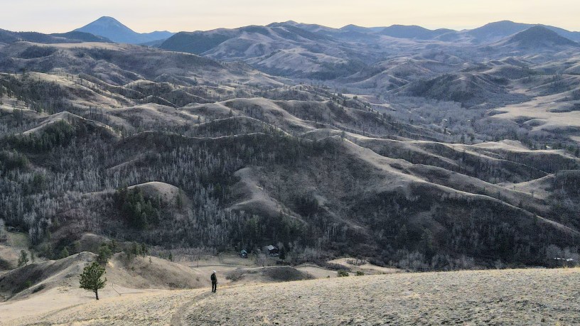
The hike to the top of Mt. Otis is only two miles round-trip with 700 feet of elevation gain – by far the easiest hike featured on this blog so far. It starts at a trailhead in Mooney Coulee and switch-backs up across the south side of the mountain. A bench on the summit provides a nice spot to sit and enjoy great views of the surrounding area. On a clear day, you can see the Sweet Grass Hills north of Chester. It would be a great hike for families with young children, allowing them to experience that “top of the world feeling” – whetting their appetite, without overwhelming them. If you go, I recommend the early fall when the aspen in Mooney Coulee are sporting their fall colors.
And you thought I was crazy.
I wanted to get some exercise, so I hiked up Otis three times before heading back into the hub of civilization to do my shopping. I was feeling pretty good about my workout until a friend (much younger) told me that he once parked his car at the base, hiked up Otis, ran down from the summit to the reservation line (on Beavercreek Road) and back up Otis six times for a total of 35 miles. He started at 9 PM and ended at 5 AM!
- Photo Tour from Mt. Otis
In the Bears Paw Mountains. - Topo map of the Mt. Otis area
Zoom in or out, scroll around.
Below: This map marks hikes that have been featured on bigskywalker.com so far, including several in Glacier Park – Select full screen to expand, zoom in for more detail, or click on a marker for a link to the post.
