
Above Paradise . . .
Emigrant Peak anchors the southern end of Paradise Valley south of Livingston, looming over one of the most scenic stretches of the Yellowstone River Valley. Although there are higher peaks in Montana’s Absaroka Range, for those who travel U.S. Route 89 to Yellowstone Park or frequent Chico Hot Springs, Emigrant Peak has a significant presence – It begs to be climbed.
Pregame plan . . .
For my friend Kacey, the pull of Emigrant Peak was strong. Determined to climb it before summer’s end, he invited our friend Tristan and I to join him, then found a date(s) that would work for all of us – Tuesday and Wednesday, August 4th and 5th (2026). That Tuesday afternoon we drove from Helena, dined in Livingston, soaked at Chico Hot Springs, then tent-camped at the Pine Creek Campground. We rose at 5 am Wednesday morning, ate a quick breakfast, packed up, and made the 25-mile drive to the Gold Prize Creek Trailhead. We started hiking shortly after 7 am.
Pleasant suprises . . .
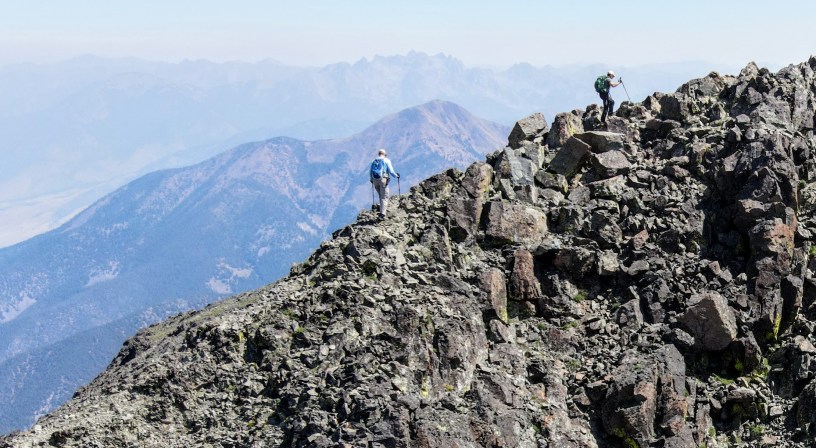
We read accounts of the climb but still weren’t sure what to expect. Fortunately Kacey picked a great day to climb – calm, sunny, and not too hot or super hazy like most days the past couple weeks. Another plus was that there was a discernible trail all the way to the summit, even up the steep rocky last half mile to the summit – totally unexpected. The trail followed a creek, veered up through a forested drainage, crossed a long open grassy slope, then switch-backed up through another patch of forest, before ascending that steep rocky ridge. The variety added a level of fun to the adventure.
Steep, steeper, steepest . . .
We knew it was only 4-miles to the summit, but we also knew that the elevation gain was 5,000 feet! Hikes seldom gain that much elevation over such a short distance. The trail climbed gradually at first but got steeper and steeper as the miles went by. It took 4.5 hours to complete the 4-mile hike – That’s less than 1 mph! Despite our slow pace, it felt like a great accomplishment to reach the summit where we spent an hour enjoying views of surrounding mountains and Paradise Valley, over a mile of elevation below us. The hike down on tired legs was no piece of cake either. We made it back to the trailhead shortly after 4 pm with an excellent understanding of what walking up 5,000 feet and back down feels like. After a short dip in the creek, we headed home – physically exhausted but happy with the way the adventure played out.
Click on the link below to check out the photo tour, including several drone photos taken from the summit.
- Photo tour of our climb to the summit of Emigrant Peak
In Montana’s Absaroka Range. - Summitpost.org
More information about climbing Emigrant.
Below: This map marks hikes that have been featured on bigskywalker.com so far, including several in Glacier Park – Select full screen to expand, zoom in for more detail, or click on a marker for a link to the post.

