
A vertical mile (almost).
I’ve scaled taller mountains and have gained more elevation in one day, but I’ve never hiked a trail that climbed so much over such a short distance. After an easy one-mile walk along trail #192 north of Seeley Lake, the climbers’ trail to the summit of Holland Peak (highest in the Swan Range) ascends almost 5,000 feet over a distance of 4 miles! Despite the incline, my hiking buddies and I enjoyed the challenging hike, especially after we caught our first glimpse of the summit from a meadow below Lower Rumble Lake (2-3 miles into the walk). From there the trail enticed us to go higher by showing us waterfalls – We wanted to see the lake this water was coming from. Then from the shore of that lake, we faced the ridge that led to the summit – What would we see from up there? This sense of anticipation, near-perfect weather, and a dose of positive peer pressure made the steep hike a very enjoyable experience. (Photo Tour)
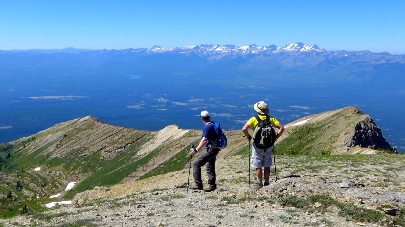
High times.
We started hiking at 8 am and reached the top at 1:15 pm, pleasantly surprised at our good fortune. There was no wind, and more importantly the skies were exceptionally clear considering the number of wildfires that have burning in the West over the past few weeks. We spent about 45 minutes snacking, playing “name that peak”, and enjoying great views of the Swan Range, the Bob Marshall Wilderness, the Mission Mountains, the distant peaks of Glacier Park, and numerous lakes scattered in the Swan Valley below. This time on the top was a nice reward for our efforts of the past 4 hours.
What goes up must come down.
Almost all good things must come to an end, and so it was with our Holland Peak adventure. We’d read reports that no one liked coming down from Holland, that it was “rough”, and that it was tough on knees and feet. We tried to put it out of our mind, figuring we would enjoy the ascent, and then “jump off that bridge” when we got to it. The first couple miles coming down weren’t horrible but miles #3 and #4 were brutal – feet slipping and toes jamming on a dirt path that was simply too steep for comfortable hiking. Fortunately the last mile (now back on Trail 192) was flat and shaded, giving the three of us time to get ourselves back into good moods before we piled into the car for the 2-hour drive back to Helena. Whew! What a day of contrasts!
Still interested?
1. Follow the directions in Cedron Jones’ book called “Peakbagging Montana”, or those found on Summitpost.org (see links below).
2. Wait for snow on the ridge to melt (often by the first of July, but this year it was later).
3. Trim your toe-nails and wear boots that have plenty of room in front of the toes. Tighten up the laces before starting down.
4. Use trekking poles. They will help going both ways.
5. Take a water filter to reduce weight in your pack and stress on your knees and feet.
6. Ibuprofen – Take a couple immediately after your hike, put your sandals on, wade out into cold stream, and drink a cold soft drink.
Links . . .
- Photo Tour of the Holland Peak Climb – July 2017
A rare clear day during an active fire season. - Interactive Topo Map of the Area
Zoom in or out, etc. - Peakbagging Montana – by Cedron Jones.
And other climbing guides. - Summitpost.org.
Much more about Holland Peak.
Below: This map marks hikes that have been featured on bigskywalker.com so far – Select full screen to expand, zoom in for more detail, or click on a marker for a link to the post.

I’m exhausted just thinking about how steep that is! All your photos are stunning. I particularly like the lake ringed with bits of snow and those incredible steep-sided mountains. Looks like you had a spectacular day.
LikeLiked by 1 person